




















































The United Nations General Assembly has voted in favour of phasing out the centuries-old Mercator world map projection in support of maps that more accurately represent the relative size of countries and continents, including Africa.
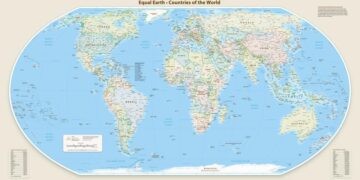
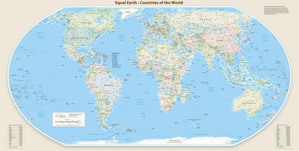
The resolution, championed by Togo on behalf of the African Union, encourages wider adoption of the 2018 Equal Earth projection, which provides a more accurate representation of land areas than the traditional Mercator map.
At the vote in New York, 164 countries supported the resolution, while the United States voted against it, describing the measure as unnecessary. Six countries abstained.
Although the resolution is not legally binding, its supporters believe it could influence the maps used in schools, public institutions and technology platforms around the world.
A centuries-old map under scrutiny
The Mercator projection was created in 1569 by Flemish cartographer Gerardus Mercator, primarily as a tool for maritime navigation.
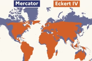
Its usefulness to sailors helped establish it as one of the most widely recognized representations of the world. However, the method used to project the curved surface of the Earth onto a flat map significantly distorts the size of land masses.
Areas closer to the poles appear much larger than they are, while regions near the equator are visually reduced.
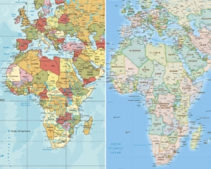
Africa is among the most striking examples. On the Mercator projection, the continent can appear comparable in size to Greenland, despite Africa being about 14 times larger.
Support
ers of the campaign to replace the projection argue that such distortions have shaped how people perceive the scale and importance of different parts of the world.
Togo’s Foreign Minister, Robert Dussey, said the debate should be viewed as a matter of scientific accuracy rather than politics.
According to Togo, the resolution recognizes that distorted maps have had lasting effects on education, culture, public perception and geopolitical understanding, particularly by reducing the perceived size of Africa and other regions in the global south.
#CorrectTheMap campaign gains global backing
The push for a new global map gained momentum through the #CorrectTheMap campaign, which argues that Africa’s true scale is consistently underestimated by the Mercator projection.
Campaigners note that the continent is large enough to contain the United States, China, India, Japan, Mexico and large parts of Europe.
The African Union endorsed the campaign in August 2025 and subsequently asked Togo to lead efforts to secure international backing for a more accurate projection.
The Equal Earth projection, developed in 2018 by an international group of cartographers, was promoted as the preferred alternative because it preserves the relative area of countries and continents more accurately.
The campaign is also supported by those who argue that the continued dominance of the Mercator map reinforces outdated perceptions of the global north and south.
Critics have described the issue as a form of “cartographic colonialism”, arguing that visually enlarging countries in higher latitudes while reducing equatorial regions can influence how people unconsciously perceive global power and importance.
France announces its own change
France also backed the broader move away from the Mercator projection.
Ahead of the UN vote, French Foreign Minister Jean-Noël Barrot said France would adopt map projections better suited to specific purposes and more faithful to actual land areas.
France is expected to use the Eckert IV projection, another equal-area design that is similar in purpose to the Equal Earth map.
The debate over the Mercator projection is not new. For decades, historians, geographers and campaigners have criticized the map for its distortions.
German historian Arno Peters became one of the best-known critics after promoting the Gall-Peters projection in the 1970s as an alternative designed to show the relative sizes of land masses more accurately.
More than a map debate
Supporters of the UN resolution say the issue extends beyond geography.
They argue that maps play a powerful role in shaping how societies understand the world and that more accurate cartography could help correct long-standing misconceptions about Africa’s physical size and global significance.
Geopolitical analyst JJ Enoch said the campaign reflected broader calls by African countries for greater influence in international institutions and more control over how the continent is represented.
He said adopting equal-area maps could improve public understanding while also reflecting Africa’s growing demographic, economic and geopolitical importance.
The next stage of the campaign is expected to focus on implementation. Togo plans to host a meeting in Lomé involving UNESCO, the African Union and technology companies, including mapping platforms, to discuss how the resolution can be translated into practical changes.
For supporters of the initiative, the vote represents an effort to change not only the maps people see but also the assumptions that have been shaped by centuries of distorted cartographic representation.